Printable 5 Regions of the United States Worksheets
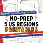
If you’re looking for printable 5 Regions of the United States worksheets to use in your homeschool, you’re in the right spot! These homeschool geography worksheets help young learners explore the Midwest, Northeast, South, Southwest, and West in a simple, hands-on way.
Kids can practice matching state names to numbers on the map, making it easier for them to remember and understand where each state belongs. It’s a fun and low-prep way to help kids build geography skills right at the kitchen table.
Plus, these printables are perfect for keeping little hands busy while learning something meaningful. In short, these worksheets make geography easy, fun, and memorable for young learners — and they’re ready to use whenever you need them!

Printable 5 Regions of the United States Worksheets
These U.S. region geography printables are a fun and simple way for kids to explore U.S. geography. Designed for young learners, these worksheets build map skills, state recognition, and understanding of regional groupings. Children strengthen their memory, improve recall, and build a solid foundation in geography while staying engaged and enjoying the activity.
What’s included:
- Regional worksheets for the Midwest, Northeast, South, Southwest, and West
- Numbered regional maps for matching states
- Clean, easy-to-read layouts are perfect for early learners
These printables make learning both educational and enjoyable, turning geography practice into a playful and meaningful experience for young children.

What can kids learn from this activity?
Kids can learn to identify and name the five main U.S. regions: Midwest, Northeast, South, Southwest, and West. They’ll practice matching state names to their correct locations on a map. This helps improve their memory and map-reading skills.
This activity also builds a stronger understanding of how the country is divided into regions and what makes each one unique. Plus, it encourages focus and attention to detail in a fun, hands-on way.

What Are the Five Regions of the United States?
The five regions of the United States are the Midwest, Northeast, South, Southwest, and West, and kids will have so much fun learning about them! With these worksheets, children get to explore how the country is divided into these regions and discover which states belong in each one.
They’ll practice recognizing names like Texas in the Southwest or New York in the Northeast, helping them connect state names to their places on the map. This section gives kids a simple, hands-on way to start understanding U.S. geography, making it easier for them to remember and talk about the different parts of the country.

How do these worksheets help kids learn the 50 states?
These worksheets help kids break down the big task of learning all 50 states by focusing on smaller regional groups. Instead of memorizing a long list, children get to match state names to their correct spot on each regional map, making the activity less overwhelming and more fun.
By working through the Midwest, Northeast, South, Southwest, and West one at a time, kids can build confidence and strengthen their memory. This hands-on practice helps them recognize state names, shapes, and locations, turning geography into a simple and enjoyable learning experience.


Scroll down for the free printables!
50 States Ideas for Kids
If you’re looking for extra ways to make learning the 50 states even more fun, you’re in the right place! Here, we’ll share simple and creative ideas that homeschool parents and teachers can use alongside the worksheet pack.
These activities will help reinforce what kids are learning while keeping them engaged and excited about U.S. geography. Let’s explore some playful ways to bring the 50 states to life!

50 States Books for Kids
Learning about the 50 U.S. states can be a big adventure for little ones, filled with fascinating facts, fun landmarks, and colorful regional stories. Books on this theme help preschoolers develop an early sense of geography and cultural diversity, all while fueling their natural curiosity.
Whether you’re a teacher planning a classroom theme or a parent looking for engaging ways to explore the map, these books bring the states to life in playful, accessible ways. Here are three charming picture books that make the journey across America fun and memorable for ages 2–7.


America: A Patriotic Primer by Lynne Cheney is a beautifully illustrated alphabet book that introduces children to American ideals and notable landmarks, blending history with state highlights. Each letter of the alphabet corresponds to a key concept or place, from “A is for America” to “Z is for Zion National Park.” This book offers a gentle introduction to national pride and a love of country.
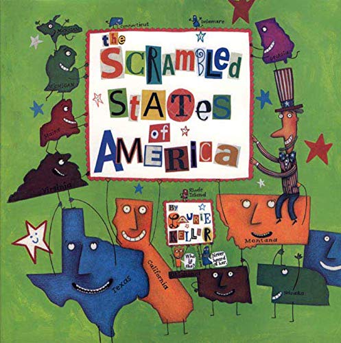
The Scrambled States of America by Laurie Keller takes a hilarious and whimsical approach to geography, perfect for preschoolers who love a good giggle. The states decide to swap places in hopes of finding new scenery, which leads to a wacky journey full of personality and fun facts. It’s a creative way to start learning where each state is located and what makes it special.
Our 50 States: A Family Adventure Across America by Lynne Cheney (yes, she wrote this one too!) follows a fictional family as they travel across the United States, stopping in each state along the way. With rhyming text and lots of interesting tidbits, it’s both educational and engaging for young readers. The detailed illustrations give kids a peek at famous landmarks, foods, animals, and more
50 States Printables for Kids
Looking for even more fun printables to help kids learn the 50 states? This section will share great resources that you can easily pair with the worksheet pack for extra practice. These printables are perfect for adding variety and keeping geography lessons fresh and engaging!
- Free Printable 50 States Flashcards
- 50 States and Capitals Worksheet
- Map of the 50 States Printable
- Free Printable 50 States Worksheets
- 50 States Worksheets


FAQ About 5 Regions of the United States Worksheets
These worksheets are great for early elementary kids, usually around ages 5–9. Younger kids might need a little help reading the state names, but they can still enjoy matching and learning. Older kids can use them for extra practice or review, making them pretty flexible for different ages.
Nope! All you need is a printer, some pencils or crayons, and a little time set aside for the activity. You can even use a U.S. map or globe nearby if your child wants to check their answers or explore more.
Try turning it into a game! You can time your child to see how quickly they can match the states or offer little rewards when they complete a region. Adding fun touches like stickers or stamps can make the activity feel even more special.

In conclusion, these five regions of the U.S. activity sheets offer a fun and simple way for kids to build their geography skills at home or in the classroom. They help young learners practice recognizing the five U.S. regions, matching state names, and improving their map-reading abilities — all through hands-on, engaging activities. Best of all, they make learning feel playful and meaningful, giving kids the confidence to explore new topics.
With just a few easy-to-use printables, you can bring valuable educational moments into your homeschool day, helping your child strengthen important skills while having fun. It’s a great way to bring geography to life for young learners!


Hi, I’m Tara—mom of three, former teacher, and now full-time homeschooler. After years in both preschool and public school classrooms, I brought the learning home and never looked back. At Homeschool Happiness, I share real-life tips, simple activities, and encouragement to help you create a homeschool life that feels good for your family—one filled with connection, laughter, and meaningful moments. We’re in this together!