50 States and Capitals for Kids
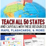
Teaching the 50 states and capitals for kids doesn’t have to be boring or overwhelming. In fact, it can be fun, hands-on, and super effective with the right tools! Here at Homeschool Happiness, we’ve created and collected engaging printable maps, kid-friendly worksheets, and simple activities to help kids confidently learn U.S. geography—without stress or frustration.
Whether you’re just introducing the states for the first time or looking for fresh ways to reinforce what your child already knows, this resource hub is packed with everything you need. You’ll find labeled and blank U.S. maps, state capitals practice, regional map activities, and creative games that make memorization easier and more enjoyable.
All of these resources are designed to work for homeschool families, classroom teachers, or anyone supporting kids as they learn about the United States. Scroll down and grab your favorites—you’ll find exactly what you need to make learning stick!

Teaching the 50 States and Capitals for Kids
Learning all 50 states and their capitals might seem like a big task, but with the right approach, it becomes an exciting adventure. In the sections below, you’ll find a variety of printable maps, worksheets, and creative activities designed to make U.S. geography fun, memorable, and easy to teach.
🧭 U.S. Regions & Geography Printables
Learning about the five U.S. regions is a great way to break down geography into manageable chunks for kids. By grouping states into the Northeast, Southeast, Midwest, Southwest, and West, children can begin to see patterns, make comparisons, and build a deeper understanding of how the United States is organized. Below are helpful printables and worksheets that support regional learning.
5 Regions of the United States Printable Map
This printable shows all 50 states color-coded by region. It’s perfect for introducing the idea of regional groupings before diving into individual state details.
👉 Download the 5 Regions of the United States Printable Map
Printable 5 Regions of the United States Worksheets
These worksheets include both labeled and blank regional maps, giving kids the opportunity to test their knowledge and practice identifying states by region. Use them for labeling practice, map quizzes, or coloring activities.
👉 Get the Printable 5 Regions Worksheets Here
Map of the 50 States Printable
If your child is ready to move beyond the regions and identify all 50 states individually, this printable includes both blank and labeled versions—great for reinforcing geography at a national level.
👉 Download the Full 50 States Map
🎵 Fun Ways to Memorize States and Capitals
Memorizing all 50 states and their capitals can feel overwhelming—especially for young learners. Rote memorization doesn’t always stick, but turning geography into a game can make all the difference. Using interactive tools like songs, flashcards, coloring games, and labeling a US map helps kids build lasting knowledge while having fun.
In this post, we’ve rounded up our favorite fun and effective strategies for helping kids retain all 50 states and capitals. Whether your child loves movement, music, or creative activities, you’ll find something that fits their learning style.
👉 Check Out These Fun Ways to Memorize States and Capitals
These ideas are perfect for visual learners, wiggly learners, and everyone in between. With the right approach, learning all 50 states for kids doesn’t just become easier—it becomes something they look forward to!
50 States and Capitals Worksheets
Practice makes progress—and these worksheets help kids master the names, locations, capitals, and abbreviations of all 50 states. Whether you’re reviewing one region at a time or jumping into a full set, these printables support independent learning, test prep, and daily geography review.
📋 Worksheet & Reference Printables:
- 👉 50 States and Capitals Worksheet
- 👉 Printable List of States and Capitals
- 👉 Free Printable 50 States Worksheets
- 👉 50 States Printable Worksheets
- 👉 State Abbreviations List Printable
- 👉 State Facts Worksheet
- 👉 Free Printable State Facts Worksheets
🎴 Flashcards:
💡 Tip: Pair these with a labeling US map for even more reinforcement.
Hands-On 50 States Activities for Kids
Make geography more engaging by giving kids opportunities to explore and create as they learn. These hands-on activities are perfect for centers, morning work, or geography-themed weeks.
🎲 Try These Fun Activities:
These are great for visual, tactile, and movement-based learners—especially when paired with flashcards, maps, or worksheets.

Make Learning the 50 States and Capitals Fun and Memorable
Teaching the 50 states and capitals doesn’t have to be stressful—it can be an exciting journey full of hands-on learning, colorful maps, and memorable activities. With the right tools and a little creativity, kids can develop a strong understanding of U.S. geography while actually enjoying the process.
Whether you’re using worksheets, flashcards, labeling maps, or playing geography games, everything you need is right here at your fingertips. At Homeschool Happiness, we’re here to make teaching easier and more enjoyable—for both you and your learners.
📎 Be sure to bookmark this page so you can come back to it throughout your geography unit, and don’t forget to download your favorite printables before you go!
Happy learning—and happy travels across the USA! 🇺🇸

Hi, I’m Tara—mom of three, former teacher, and now full-time homeschooler. After years in both preschool and public school classrooms, I brought the learning home and never looked back. At Homeschool Happiness, I share real-life tips, simple activities, and encouragement to help you create a homeschool life that feels good for your family—one filled with connection, laughter, and meaningful moments. We’re in this together!