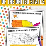
5 Regions of the United States Printable Map
Teaching the 5 regions of the United States printable map can be super fun with the right activity! These homeschool geography worksheets are a great way to help young kids learn about the different regions in a hands-on, colorful way.
The printable map is easy for students to follow and gives them a clear visual of how the United States is divided. It’s also a great way to practice basic map skills without feeling overwhelmed. Whether working one-on-one with your child or teaching a small group, this simple resource fits into any geography lesson.
In short, this printable makes it easy to teach essential geography skills while keeping things fun and stress-free!

5 Regions of the United States Printable Map
Make learning geography easy and fun with these 5 regions U.S. map printables! These printables are an excellent way for young learners to practice essential skills like map reading, regional recognition, fine motor development (with coloring), and early critical thinking. Designed to be engaging and straightforward, these worksheets help kids connect with geography in a hands-on, colorful way.
With this printable set, you’ll get:
- A blank 5-region map for kids to color and label
- A color key to guide children as they work
- An answer key to make checking easy
- Clear, kid-friendly layouts perfect for early learners
These worksheets are a great addition to any homeschool geography lesson or classroom activity. They turn learning into a fun, confidence-boosting experience without feeling overwhelmed or too complicated.
This set offers a perfect mix of education and enjoyment, helping kids build geography skills while having fun!

What can kids learn from this activity?
Kids can learn a lot from the United States regions worksheet! They’ll start to recognize the five major regions and understand how the United States is organized geographically. This activity also helps them build basic map skills, like reading a map key and using color-coding to show information.
Children practice fine motor skills as they work by coloring neatly and labeling different areas. It’s a great way to introduce bigger ideas like states, regions, and landforms in a simple, age-appropriate way.
Activities like this encourage kids to observe patterns and consider how places are connected. It’s a fun, hands-on way to build a foundation for later social studies learning!
How do I teach the five regions of the United States?
A great way to teach the five regions of the United States is by starting with a simple, colorful map that shows each region clearly. Talk with your kids about how the country is divided into different areas based on location, weather, and landforms.
Kids can color each region differently using a printable map to help them remember. As you work, point out a few states in each area and discuss what makes them special. Keep the lesson light and interactive by asking questions like, “Which region do we live in?” or “Where would you like to visit?”
You can also add fun activities like puzzles, games, or simple books about U.S. geography to make learning stick. The key is to keep it hands-on, simple, and fun!

Color-Coding and Categorization Skills
Color-coding the printable U.S. regions map is a fun and simple way to help kids practice essential categorization skills. When children use different colors for each region, they learn how to group similar items, a key skill for organizing and understanding information.
It also helps them make quick visual connections — they can easily look at the map and see which states belong together. This kind of visual sorting builds early thinking skills that children will use later in subjects like science, reading, and math.
Plus, the hands-on coloring makes it easy for young learners to stay engaged while they organize information meaningfully. Activities like this show kids that breaking information into groups can make big topics feel smaller and easier to understand.


Scroll down for the free printables!
US Geography Ideas for Kids
Looking for even more ways to make learning about the United States fun and hands-on? Add many simple activities to this printable pack to help kids dive deeper into U.S. geography. Whether you’re looking for crafts, worksheets, or books, these ideas are a great way to keep young learners excited and engaged while they explore the regions of the United States.

Picture Books About the 50 States
Introducing young learners to the United States can be a big adventure, and picture books are the perfect way to make it fun and memorable! Whether studying geography, planning a road trip, or celebrating a love for the red, white, and blue, these delightful books offer engaging stories and colorful illustrations that bring all 50 states to life. Here are three excellent choices for preschoolers and early elementary kids ready to explore America, one page at a time.


America: A Patriotic Primer by Lynne Cheney is a beautifully illustrated alphabet book that introduces children to American ideals and notable landmarks, blending history with state highlights. Each letter of the alphabet corresponds to a key concept or place—from “A is for America” to “Z is for Zion National Park.” This book briefly introduces national pride and a love of country.
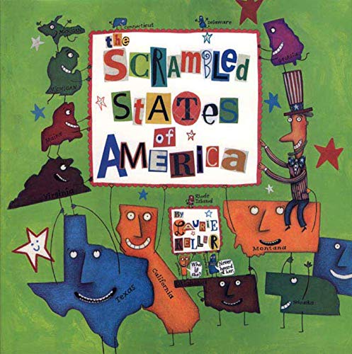
The Scrambled States of America by Laurie Keller takes a hilarious and whimsical approach to geography, perfect for preschoolers who love a giggle. The states decide to swap places, hoping to find new scenery, leading to a wacky journey full of personality and fun facts. It’s a creative way to start learning where each state is located and what makes it special.
Our 50 States: A Family Adventure Across America by Lynne Cheney (yes, she wrote this one, too!) follows a fictional family traveling across the United States, stopping in each state. With rhyming text and many interesting tidbits, it’s educational and engaging for young readers. The detailed illustrations give kids a peek at famous landmarks, foods, animals, and more.
US Geography Printables for Kids
Printable activities are a great place to start if you’re looking for even more fun ways to teach geography! They make adding hands-on learning to your homeschool or classroom plans easy without much prep. Here are some more printable resources you can use to keep the geography fun going.
- USA Geography Printables for Kids (Free Printables)
- Arkansas Geography for Kids: Printable State Activity Pack
- US Map Geography Games for Kids
- 3D Salt Dough Maps for Kids
- United States Geography Lessons


FAQ About 5 Regions of the US Printable Map
This printable is great for kids in kindergarten through around third grade. The map is simple enough for younger kids to color and recognize regions. However, it’s still a helpful tool for early elementary students who are starting to learn more about geography. Depending on your child’s age and ability, you can easily adjust how much detail you go into.
Keep it super simple! I like to say that a state is like one small part of the United States, and a region is a group of states that are close together and share some things in common, like weather or land features. Using the color-coded map helps kids “see” the difference without getting overwhelmed by too much information at once.
Absolutely! This printable pairs well with read-aloud books about the United States, simple puzzles of the U.S. map, or even virtual field trips to different parts of the country. You could add matching games, craft projects, or mini research activities where kids learn one fun fact about each region. It’s easy to mix and match activities depending on what your kiddos enjoy most!

Teaching kids about the 5 regions of the United States doesn’t have to be complicated, and with simple tools like these printable maps, it can even be fun! Activities like coloring, labeling, and categorizing help young learners build essential geography skills in a way that feels easy and natural. Plus, using hands-on resources like this encourages kids to stay curious and excited about learning new things.
With just a little time and a few simple materials, you can give your child a strong foundation in U.S. geography and essential thinking skills they’ll use across all subjects. This printable map set is an easy way to bring learning to life and make geography a part of your everyday homeschool routine.


Hi, I’m Tara—mom of three, former teacher, and now full-time homeschooler. After years in both preschool and public school classrooms, I brought the learning home and never looked back. At Homeschool Happiness, I share real-life tips, simple activities, and encouragement to help you create a homeschool life that feels good for your family—one filled with connection, laughter, and meaningful moments. We’re in this together!